Ocean salt water entering Delaware River due to drought and sea level rise, water managers say
Source: ABC News
November 27, 2024, 5:14 PM
Drought and sea level rise have caused salt water from the Atlantic Ocean to creep into the Delaware River Basin, a major source of drinking water for Philadelphia and the surrounding area, officials say.
The Delaware River's salt front -- the line where ocean water and freshwater meet -- has been shifting upstream from its typical spot near Wilmington to about 20 miles north, near the Philadelphia International Airport and closer to the intake for drinking water, Amy Shallcross, manager of water resource operations at the Delaware River Basin Commission, said.
"When flows are really low, that's when the salt front will start to creep upstream," Shallcross said. Drinking water has not yet been affected, but water management officials are taking urgent measures to prevent the ocean water from tainting the water supply, Shallcross said. One of the contingency efforts includes tapping two nearby reservoirs to push the unpotable waters back downstream, Shallcross said. The flows released are roughly equivalent to two Olympic-sized swimming pools per minute.
"As conditions become more and more serious, or drier and drier, then we'll need to release more water," Shallcross said. "And so it's really a balance between keeping water in storage for water supplies versus releasing water to repel salinity or to push the salt downstream."
Read more: https://abcnews.go.com/US/ocean-salt-water-entering-delaware-river-drought-sea-level-rise/story?id=116270464

In this graphic released by the Delaware River Basin Commission, the salt front location is shown.
Delaware River Basin Commission
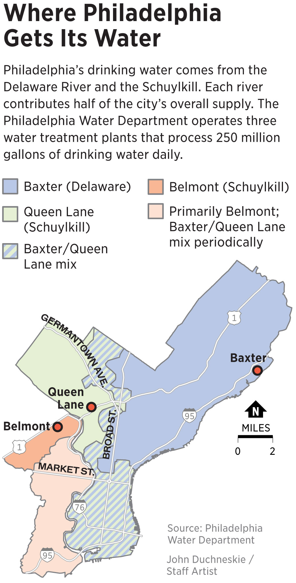
My water comes from the OTHER river that runs through Philly - the Schuylkill (the river shown in the below pic) -

Philadelphia skyline
STOOCK PHOTO/Getty Images
JustAnotherGen
(33,811 posts)Hunterdon County is still in drought. I cross at New Hope when I drive into work at the office.
You can see the water line of the Delaware on the banks.
Think. Again.
(19,041 posts)Walleye
(36,390 posts)BumRushDaShow
(144,196 posts)We "normally" get remnants from tropical systems in late summer through fall but that didn't happen this year. There are some reporting sites within the Mt. Holly NWS coverage that are breaking or have broken their "driest 3-month period" ( "autumn" and/or "any" ) on record.
.CLIMATE...
Driest autumn (Sep-Nov) on record, and any 3-calendar month period
on record, plus current status:
9/1-11/27 Driest Driest 3 Year/
Site 2024 precip Autumn Year Calendar months months
Allentown (ABE) 3.02 3.81 1922 3.58 Oct-Dec 1928
A.C. Airport (ACY) 2.27 3.34 2001 2.35 Oct-Dec 1946
A.C. Marina (55N) 1.68 2.89 1941 2.52 Aug-Oct 1895
Georgetown (GED) 1.43 2.67 2001 2.20 Aug-Oct 2024
Mount Pocono (MPO) 5.34 4.21 1931 3.36 Oct-Dec 1928
Philadelphia (PHL) 2.50 2.37 1922 2.37 Sep-Nov 1922
Reading (RDG) 2.44 2.89 1922 2.89 Sep-Nov 1922
Trenton (TTN) 2.26 3.18 1922 2.66 Jun-Aug 1966
Wilmington (ILG) 2.14 3.17 1922 3.17 Sep-Nov 1922
&&
Botany
(72,660 posts)We are truly fucked.
mopinko
(71,952 posts)they’re gonna f things up, royally, then hide the stats.
Botany
(72,660 posts)…. with salt water. 100s and hundreds of acres. However Trump promised the fossil fuel companies
if they gave him a billion $s and supported him he would lift all climate laws and rules.
![]() I wonder if they “helped” in his miraculous win?
I wonder if they “helped” in his miraculous win?
https://www.nbcnews.com/science/environment/ghost-forests-creep-us-east-coast-rcna2142
Igel
(36,229 posts)So drawing them down just to provide flow might wind up getting in the way of what is obviously a lesser group of people being served. Either numerically or in terms of importance.
Do what I've head others have done: move the intake ports upriver, either by canal or pipeline. I mean, LA has huge underground water channels that they built to bring in water from the mountains.
The Schuylkill intake point may not be safe, either. Depends on the elevation of the intake and water flow rates. Brackish water can move up the Schuylkill just as well as it can move up the Delaware, provided that the pressure and elevation work out just wrong.
BumRushDaShow
(144,196 posts)which is below the Fairmount Dam. Where the Art Museum sits now is on the mound that used to be an elevated reservoir that provided water to the city (and the waterworks, which pumped the water as part of that, is are still there)!
The gauge is just north of 30th & Market (near that 2nd bridge in the below close to the upper right corner).


And there is a whole watershed that helps to feed it too. The intakes for it are further north/west of where the Schuylkill feeds into the Delaware.
