On Slicks and Satellites: An Open Source Guide to Marine Oil Spill Detection (bellingcat)
https://www.bellingcat.com/resources/how-tos/2024/08/30/marine-oil-spill-detection-guide/
(many links, more, at source)
On Slicks and Satellites: An Open Source Guide to Marine Oil Spill Detection
August 30, 2024
Almost every week, oil spills are reported somewhere in the world. From ships dumping contaminating ballast water or breaking down on coral reefs, to direct attacks on oil pipelines and tankers. The larger the spill, the bigger the media attention.
This year alone, off the coast of Trinidad and Tobago, a Bellingcat investigation found that 1,000 tonnes of oil contaminated protected wetlands and wildlife sanctuaries after a barge capsized. In the Middle East, the Houthis targeted the Liberia-flagged tanker, Chios Lion. Carrying a cargo of crude oil, the strike resulted in a 200-kilometre-long oil slick. And in South-East Asia, in late July, the tanker, MT Terra Nova, carrying 1.4 million litres of industrial oil, capsized off the coast of Manila in the Philippines, causing a four-km-long engine oil spill.
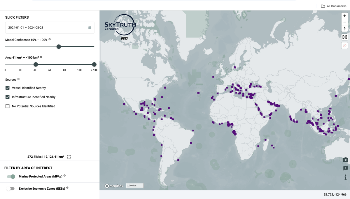
 Screenshot from Cerulean, Skytruth, one of several free global monitoring systems that aims to detect oil pollution from vessels and offshore oil platforms
[...]
How to Identify an Oil Spill
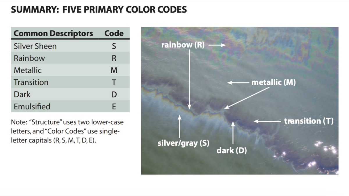
The National Oceanic and Atmospheric Administration (NOAA) toolkit offers solid guidance on how to recognise and label different types of oil and how they might appear on the water.
 Screenshot from the NOAA toolkit. By labelling the different colours and formations, responders are better able to identify what type of oil they are dealing with and what could happen next
[...]
Additional tools to NOAA include the Australian Marine Authorities Oil Spill Aerial Observation and Identification guide and the International Petroleum Industry Environmental Conservation Association (IPIECA) Guidelines.
[...]

