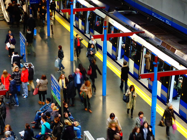
Why Berlin’s transit system rocks
from The Source:
Posted March 19, 2013 by Kim Upton
Transit notes on Berlin, Germany — easy does it

On a recent trip to Berlin, I abstained from car travel and instead relied on 7 Euro (about $9) day passes to take me around town on the U-Bahn, the S-Bahn and the bus. I was seldom confused, always on time and saved tons of money. The money part was a good reminder of how expensive it is to drive anywhere. Even though Californians have ample reason to complain, in Berlin gas prices are more than twice what they are in L.A.
The ease and frequency of Berlin transit has a lot to do with the maturity of the massive system that began construction in the early 1900s. Just think what the L.A. system could look like 100 years from now.
Among factors contributing to ease of travel:
– Constant updates. As studies have shown, confident travelers are happy travelers. Constant real-time arrival updates on electronic boards in S-Bahn (above ground) and U-Bahn (subway) stations and most bus stops made waiting for the next train or bus comfortable, even when the next one was 20 minutes away.
– Names. Station names in Berlin tend to be utilitarian, marking locations or major sites. Headed for the Zoo? Get off at Zoologischer Garten. Taking a trip to Potsdam? Go to Potsdam Stadt. Off to the Olympic Stadium? Head for Olympiastadion. Simplicity in names promotes clarity. ....................(more)
The complete piece is at: http://thesource.metro.net/2013/03/19/transit-notes-on-berlin-germany-easy-does-it/
darkangel218
(13,985 posts)That one has to travel. Europe is small. Really tiny. That is why public transportation is effective. If you'd see the old and outdated busses/trams/ trolleys they use. They only work because its such a short route.
Imo, US public transportation is not bad at all, considering the distance.
marmar
(78,064 posts)And what old, outdated trolleys are you talking about? ...... Have you been to Europe lately? Most of the big cities have very advanced transit systems that put ours to shame.


What about this is old and outdated?
Lydia Leftcoast
(48,219 posts)The older cities or parts of cities that were developed before the spread of the automobile are compact like European cities. It's only the post World War II sections of cities that are spread out.
Nature didn't lay the U.S. out in one-acre lots.
jollyreaper2112
(1,941 posts)Extremely low-density but with most homes built along the lines of what could fit in the usual suburb. They just said "Hey, instead of midsized house in a regular yard, let's make the yards bigger!" That's the only difference. Such stupidity.
CreekDog
(46,192 posts)yet it's transit is AMAZING.
New York City is more dense than Berlin. Both have great transit systems.
Berlin is just a city where they have covered a fairly sprawling city without a really defined or dense center with a U-bahn (urban subway), an S-bahn (a urban-suburban subway/railway) and centric rings of light rail. Yes, this system gets you out into the suburban areas amazingly well.
The USA could have such a system if it wanted to have one.
Germany insists on such systems and Berlin's and Munich's are among the best around.
Lydia Leftcoast
(48,219 posts)although the names are usually those of neighborhoods rather than of sites. However, some of the subway stations and many of the bus stops are named after specific sites, such as the National Diet Building, the Mitsukoshi Department Store, the Tokyo Metropolitan Government Building, etc.
DetlefK
(16,479 posts)If you go by car/bike/foot, you need the names of streets and places to plan your way.
In your mind, the city is made up of paths.
But if you go by bus/subway/S-Bahn those names are entirely meaningless! You don't operate on a street-map anymore! Public transportation has its own routes of traffic and you can't change them.
In your mind, the city is now made up of isolated stations and the venues nearby.
That's why it's much more intuitive to name stations after venues: If you go by public transportation, the "how" of getting there becomes meaningless. Instead of a whole map, you just have to remember the immediate areas around the stations you care about.
Lydia Leftcoast
(48,219 posts)the neighborhoods that the stations are named after are the "ghosts" of villages that were swallowed up by the city.
So customarily, people say things like, "Our meeting is at Forum 8."
"Where is that?"
"It's in Shibuya. Go out the Hachiko Exit and you'll see two streets in front of you. Take the one that veers to the left and go about four blocks, about two or three buildings past the McDonald's."
CreekDog
(46,192 posts)Einsteigen.