Welcome to DU!
The truly grassroots left-of-center political community where regular people, not algorithms, drive the discussions and set the standards.
Join the community:
Create a free account
Support DU (and get rid of ads!):
Become a Star Member
Latest Breaking News
Editorials & Other Articles
General Discussion
The DU Lounge
All Forums
Issue Forums
Culture Forums
Alliance Forums
Region Forums
Support Forums
Help & Search
Anthropology
Related: About this forumHundreds of Ancient Maya Sites Hidden Under Mexico Reveal a Mysterious Blueprint

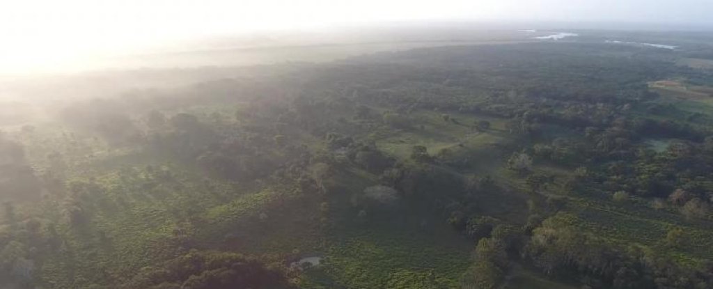
Aerial view of Aguada Fénix. (Takeshi Inomata)
HUMANS
Hundreds of Ancient Maya Sites Hidden Under Mexico Reveal a Mysterious Blueprint
PETER DOCKRILL 26 OCTOBER 2021
You can't see them from the surface, but they're definitely there. Scientists have revealed the discovery of hundreds of ancient ceremonial sites, many of which belonged to the Maya civilization, hiding in plain sight just underneath the landscape of modern-day southern Mexico.
The largest of these structures – called Aguada Fénix – was announced by archaeologists last year, representing the oldest and biggest monument of the ancient Maya ever found. But Aguada Fénix clearly was not alone.
In a new study, an international team of researchers led by anthropologist Takeshi Inomata from the University of Arizona reports the identification of almost 500 ceremonial complexes tracing back not just to the Maya, but also to another Mesoamerican civilization who made their mark on the land even earlier, the Olmecs.
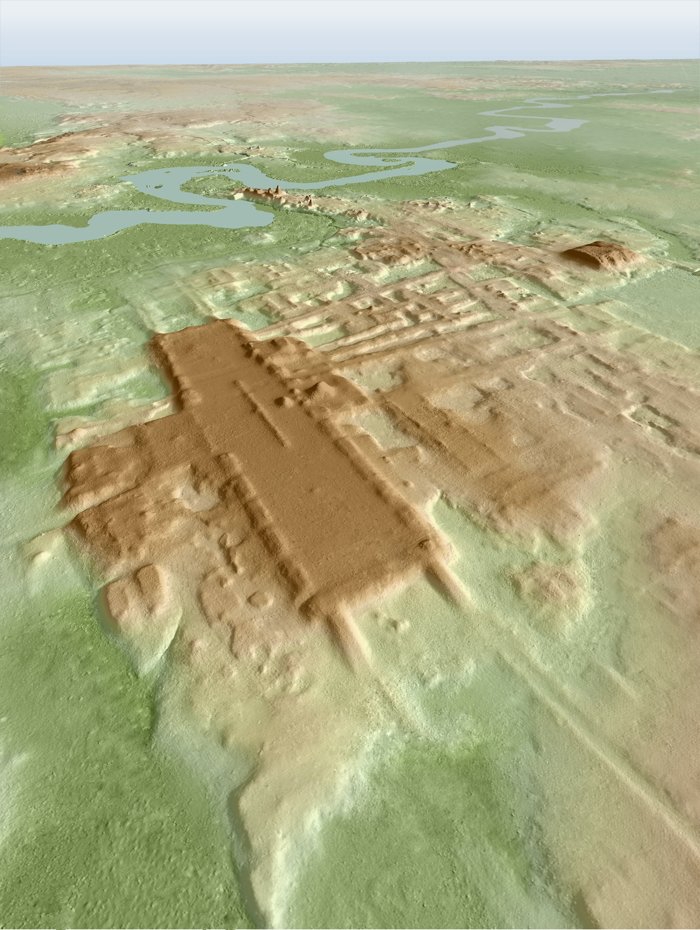
As with the discovery of Aguada Fénix, the sites identified in the new analysis (478 in total) were found the same way: using LIDAR, which combs the land with lasers during an aerial survey, detecting three-dimensional archaeological structures buried beneath vegetation and other surface features.

3D image of the site of Aguada Fénix based on LIDAR. (Takeshi Inomata)
More:
https://www.sciencealert.com/hundreds-of-ancient-maya-sites-hidden-under-mexico-reveal-a-mysterious-blueprint
InfoView thread info, including edit history
TrashPut this thread in your Trash Can (My DU » Trash Can)
BookmarkAdd this thread to your Bookmarks (My DU » Bookmarks)
2 replies, 1392 views
ShareGet links to this post and/or share on social media
AlertAlert this post for a rule violation
PowersThere are no powers you can use on this post
EditCannot edit other people's posts
ReplyReply to this post
EditCannot edit other people's posts
Rec (22)
ReplyReply to this post
2 replies
 = new reply since forum marked as read
Highlight:
NoneDon't highlight anything
5 newestHighlight 5 most recent replies
Hundreds of Ancient Maya Sites Hidden Under Mexico Reveal a Mysterious Blueprint (Original Post)
Judi Lynn
Oct 2021
OP
Hidden Maya complexes hint that the famous calendar was already in use 3,400 years ago
Judi Lynn
Oct 2021
#1
Judi Lynn
(162,376 posts)1. Hidden Maya complexes hint that the famous calendar was already in use 3,400 years ago
By Stephanie Pappas about 1 hour ago

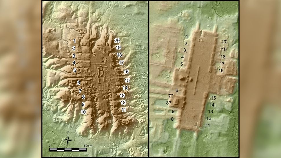
These lidar images show San Lorenzo (left), an Olmec site that peaked between 1400 B.C. and 1150 B.C.), and Aguada Fénix (right), a Maya site primarily occupied between 1000 B.C. and 800 B.C. Both show a similar pattern of 20 rectangular platforms lining the plaza. In later Maya calendars, 20 was the base unit for counting days, suggesting that this timekeeping system was already in development before 1000 B.C. (Image credit: Takeshi Inomata)
Ancient Central American people may have designed their cities around an early iteration of the Maya calendar.
A new study of ancient population centers in western Guatemala and southern Mexico reveals 478 separate complexes, many of which seem based on a prototype city built around 1400 B.C. Many of these complexes have never been discovered, surveyed or excavated until now. But their shapes, detectable from above with a technology called lidar — which stands for "light detection and ranging" — suggest many were oriented with the sunrise on certain important days and seemed to use the number 20, — the basis of later written calendars, — as their fundamental unit.
"We don't have the written calendar at this time yet," said Takeshi Inomata, an archaeologist at the University of Arizona and the lead researcher of the new study. "[That] comes much later, several centuries later than these sites. But this is a very tantalizing sign that actually people already had a calendar system that's based on the number 20."
Maya calendars and Mesoamerican architecture
The calendar that seemed important in constructing these sites is not the famous Maya calendar that some claimed predicted the end of the world in 2012. That's the Maya Long Count calendar, which was designed for keeping track of very long spans of time. For shorter periods, the Maya also worked with the 260-day Tzolk'in calendar, which they used for scheduling religious rituals, and the Haab', a 365-day calendar based on Earth's rotation around the sun. The Tzolk'in and the Long Count calendars both used repeating cycles of 20 for counting the days. Written versions of the Long Count calendar are found from from A.D. 800 and later, Live Science previously reported.
More:
https://www.livescience.com/maya-olmec-city-plan.html?utm_source=notification
Judi Lynn
(162,376 posts)2. Archaeologists used lasers to find nearly 500 Mesoamerican monuments hidden in the Mexican jungle
Aylin Woodward Oct 28, 2021, 1:44 PM

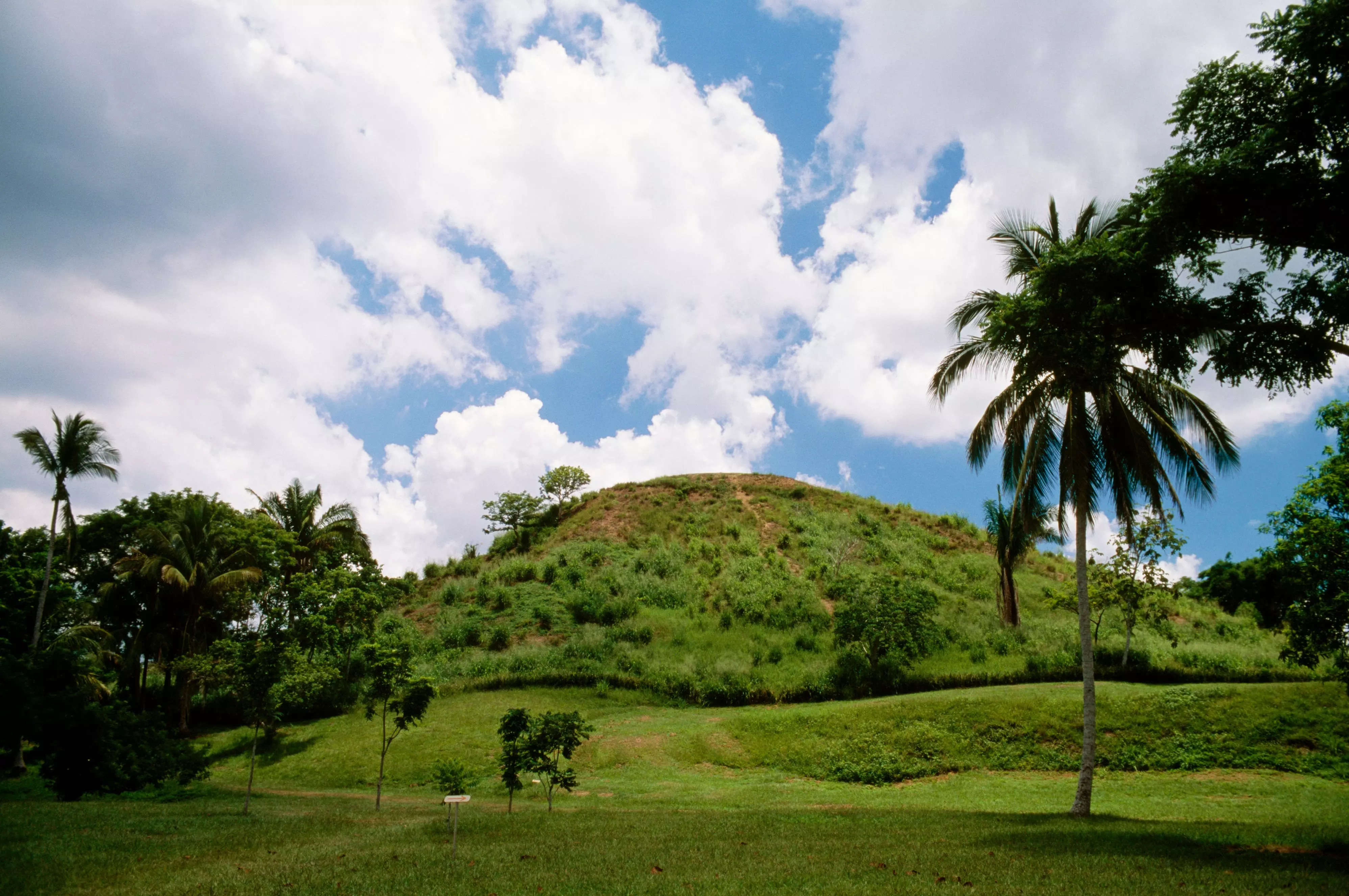
A grass-covered pyramid named La Venta, in Tabasco, Mexico. The site dates back to the Olmec civilization. DeAgostini/Getty
Several millennia ago, the Olmec and Maya civilizations flourished in what are now Mexico and Guatemala. They built massive stone pyramids and elevated rectangular plazas for rituals and ceremonies, but over time many these sites were lost to the jungle, subsumed under dense vegetation.
But over the last few years, archaeologists have started leveraging a new technology to find these hidden, Mesoamerican ruins: LIDAR, a system that can generate three-dimensional maps by bouncing lasers between a scanner in the air and the Earth below.
LIDAR, which stands for light detection and ranging, can reveal how close or far away the ground is from the scanner, which in turn helps reveal discrepancies in the landscape.
In a study published Monday, researchers describe how they used this kind of laser mapping data to uncover nearly 500 Mesoamerican sites between about 2,000 and 3,000 years old.
More:
https://www.businessinsider.com/laser-mapping-technology-uncovers-lost-mesoamerican-ruins-mexico-2021-10