Space City Weather Update on Beryl [View all]
My part of the greater Houston area is in the direct path of Beryl
https://spacecityweather.com/beryl-tracking-toward-matagorda-center-likely-to-pass-near-west-side-of-houston-serious-impacts-expected/
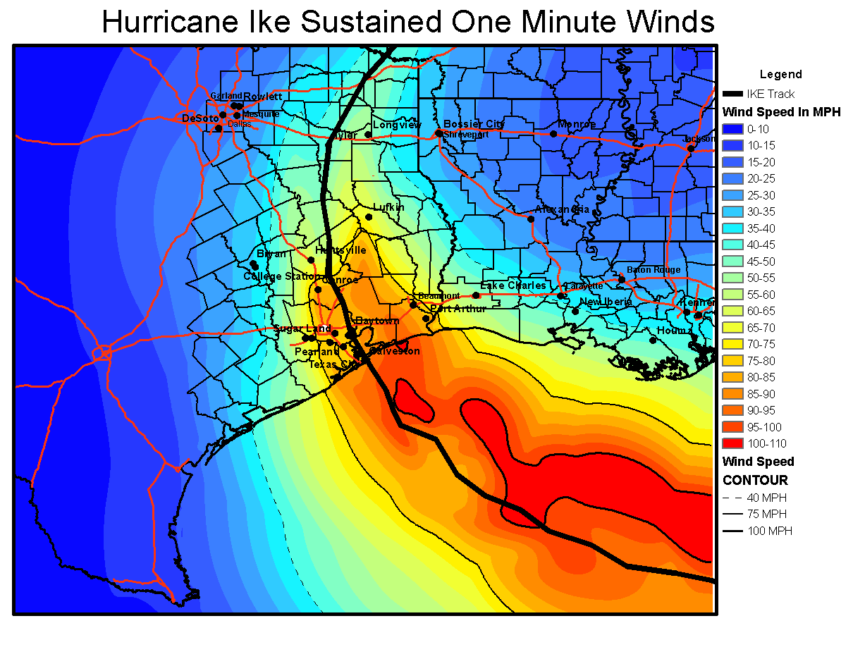
Matagorda, Wharton, Fort Bend, and Brazoria counties are likely to see the strongest winds, with sustained winds of 45 to 75 mph, and higher gusts. Most of the rest of the Houston metro area is at risk for winds of 35 to 55 mph, with higher gusts. If you’re wondering how these compare to Hurricane Ike, here is a map of sustained peak winds during that notable 2008 hurricane.
These winds will peak between late Sunday night and sunrise for coastal areas, and a little bit later for inland areas. Winds will be receding area-wide by Monday afternoon.
I remember that Hurricane Ike was at one point headed straight at me but at the last minute changed course and went up the Houston ship channel. Beryl is weaker than Ike. I love the Space City people. They posted a chart showing the wind speeds for Ike and according to the chart, I will have less wind with Beryl at my home than I got with Ike.

I lost power with Ike for two or three days. There were parts of Houston who lost power for three or four weeks. I have a generator now and a new internet provider (I have had cable and internet during a couple of power outages).
Again, I love the Space City guys. Hopefully they are correct about Beryl
Beryl will be an impactful storm for the Houston region. This is far from a worst-case scenario hurricane for our area, but it will be significantly disruptive tonight and on Monday. Beginning this evening, you should shelter in your home. The worst of the winds and rains will come tonight and into Monday morning, with improving conditions thereafter. Due to the likelihood of street flooding on Monday morning, you should carefully consider any plans before noon.
The current track forecast indicates the possibility of widespread power outages, and the duration of these outages will depend on how many people lose power as it will mean more work for restoration crews.
I keep thinking that there may be a shift in Beryl like Ike. You never know with Houston hurricanes
We have a round of thunderstorms moving in and I just drugged my bearded collie.
